This post was guest authored by Denise Wright, GIS Analyst II in Digital Initiatives at the Tampa Library
In a world of satellite imagery and interactive maps, it’s easy to forget that some of our most important mapping tools have deep historic roots. One of those tools is the Mercator projection, developed by Gerardus Mercator in 1569. This spatial projection transformed nautical navigation by representing compass directions as straight lines. It works by projecting the Earth onto a cylinder tangent to the equator, preserving angles and shapes locally but exaggerating the size of land near the poles. Despite its distortion at higher latitudes, the Mercator projection is widely used today in mapping nautical charts, web maps, and even Google Maps because of its clear sense of direction and straight-line navigation.
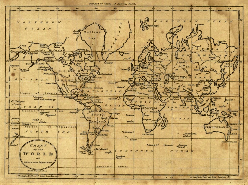
After finding the USF Libraries Early Printed Map Collection, I wondered to myself how relevant the historic maps are today. Could they be projected in 3D using today’s technology? Equipped with GIS software, longitude and latitude data, and Amos Doolittle’s 1796 “Chart of the World on Mercator’s Projection” I set out to answer this question. The result? The 229 year old map aligned surprisingly well, a powerful reminder of the projection’s long-standing precision and influence.
An important adaptation of this projection is the Transverse Mercator, which rotates the cylinder so it touches the Earth along a meridian instead of the equator. This change makes it ideal for mapping narrow, north-south-oriented areas with less distortion. That’s why Florida’s , which is used for everything from property boundaries to infrastructure planning, relies on the Transverse Mercator projection for its north-south zones.
But in 2026 Florida’s map coordinates are getting an upgrade. As part of a national initiative to modernize the National Spatial Reference System (NSRS), managed by the National Geodetic Survey (NGS), Florida is updating its coordinate system to SPCS2022. This modern version aligns with new GPS standards and offers higher accuracy and better compatibility with modern technologies like drones, remote sensing, and high precision surveying.
The update ensures Florida stays on the cutting edge of geospatial technology while remaining grounded in the powerful mathematics of a centuries-old projection.
References
Doolittle, Amos, “Map, Chart of the World on Mercators Projection, 1796” (1796). Early Printed Map Collection. Image 18.
https://digitalcommons.usf.edu/fl_maps_early/18
National Geodetic Survey. (2023, May 19). NSRS modernization training. NOAA. https://geodesy.noaa.gov/training/nsrs-modernization/index.shtml